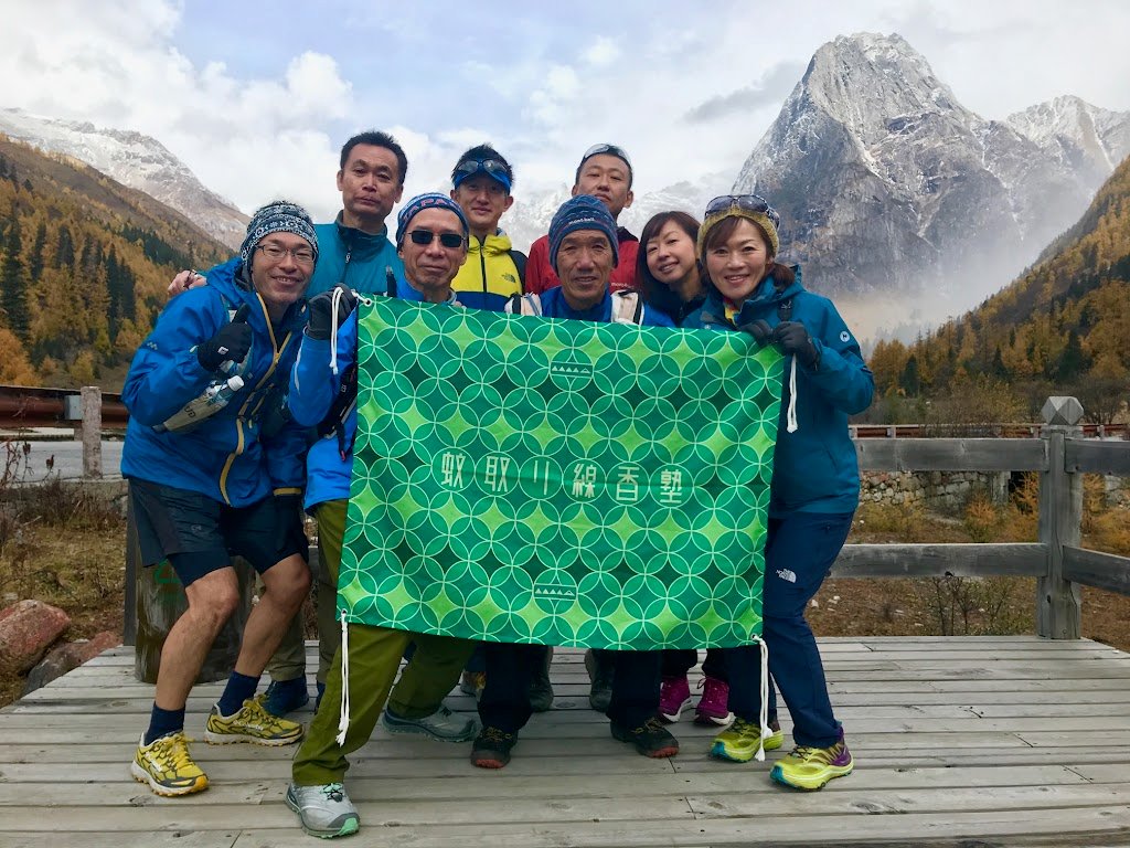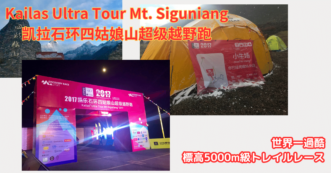
A Japanese woman who participated in Ultra Tour Mt. Siguniang (Four Girls Mountains) held in Tibet, Sichuan, China, has contributed the race participation report.
I have participated in Ultra Tour Mt.Siguniang 2017, and I would like to report how it went.
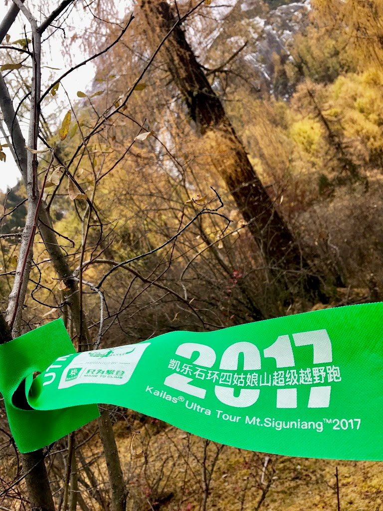
A grueling race set at an altitude of 3230m to 4500m
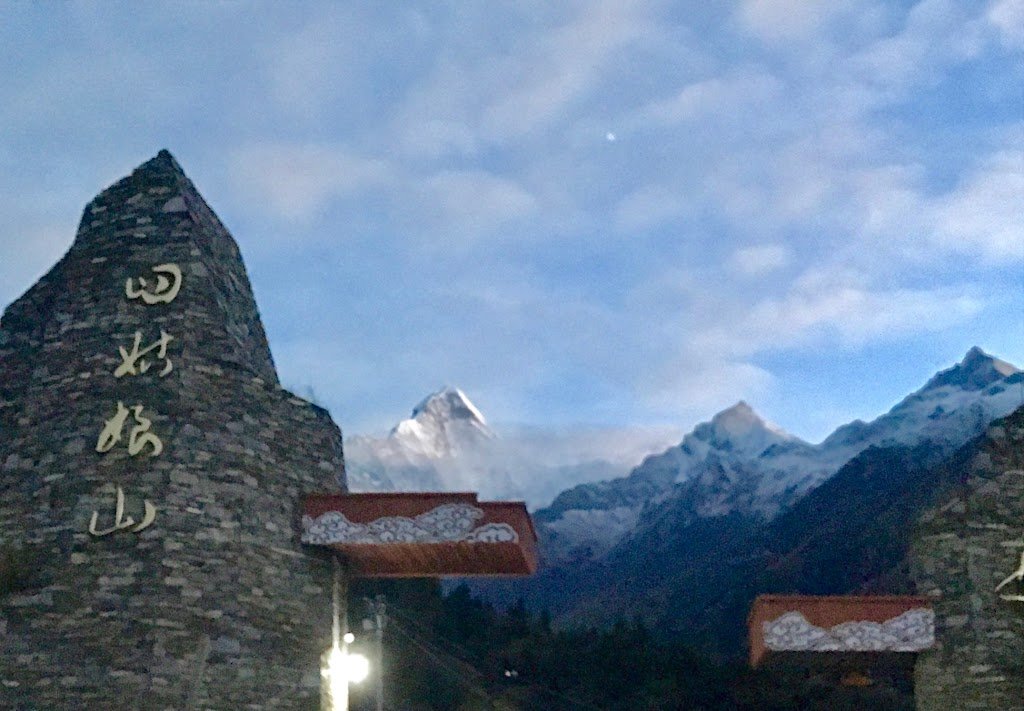
The UTMS, one of the Ultra Trail World Tour, was held on Saturday, November 4, in the Four Girls Mountains in the Tibetan Autonomous Prefecture of Sichuan Province, China.
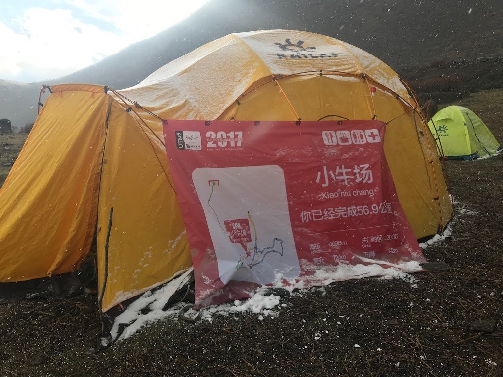
The race’s starting point, Lilong, is at 3230m above sea level, and the highest point reached is 4500m. The categories are 42.5 km, 50 km, 60 km, and 100 km, each with a different course, allowing runners to enjoy not only the distance but also choosing the scenery they want to see and the mountains they want to visit. Due to the low finish rate, the course was revised in the past years, with the highest point reached in China being set at 5000m or less, and a 50km category being newly established. The members from Japan who participated in this year’s UTMS competed in their respective categories, but they struggled greatly due to the snow that fell the day before the race, altitude sickness, and other damaging factors.
In order to participate in the UTMS, participants are required to have mountaineering experience, experience spending time at high altitude, trail running experience, and other qualifications. It is difficult for Japanese people to meet these requirements in their normal lives, but I myself secretly trained for the race at high altitude based on the advice of Mr. Mosquito Repellent, who was with me this time. However, I was anxious about the unfamiliar environment and wanted to finish the race because I was going to participate, so I decided to challenge the 50 km course, which is said to be the calmest among the four categories.
Access, Reception, and Climate
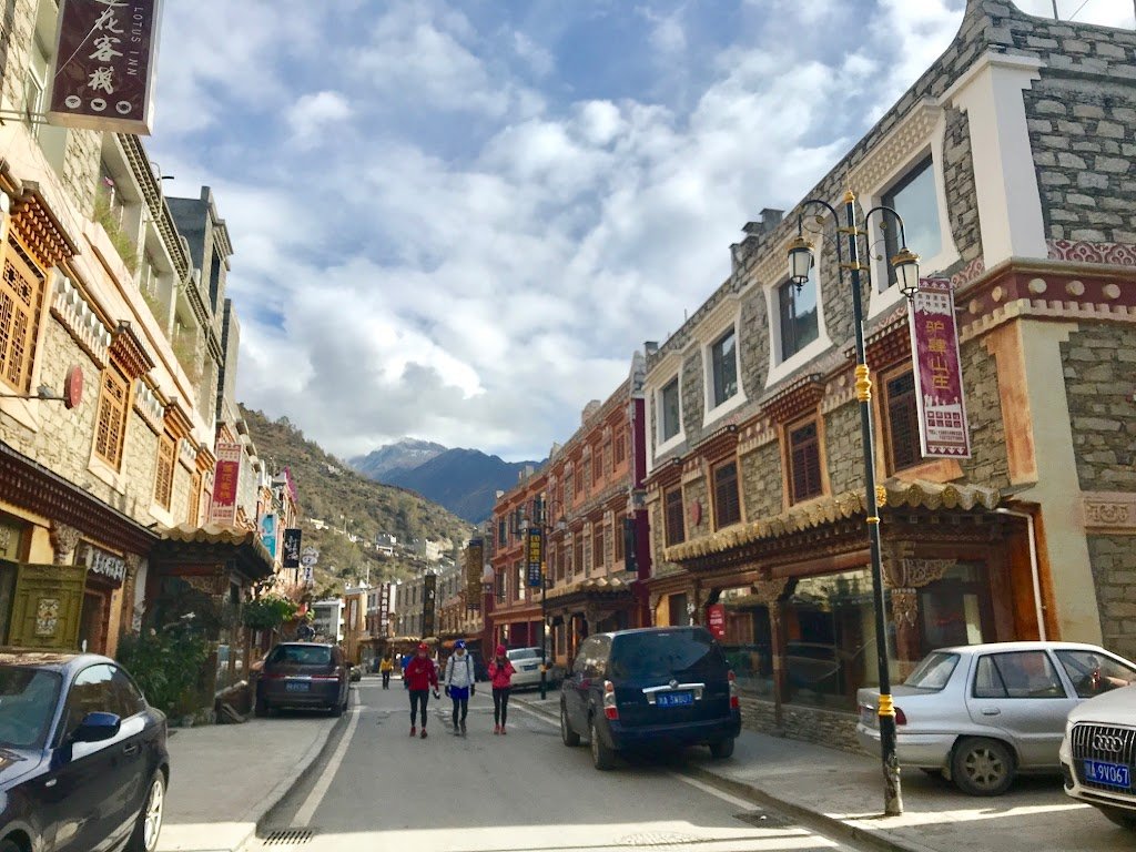
Chengdu, the entrance to Tibet from Japan, is a 5-hour and 40-minute direct flight from Narita Airport. A car was arranged to take us to the venue, which took 4 hours, crossing a mountain pass at an altitude of 4,000 meters on the way. It was a drive that made us realize the grandeur of the earth, with cars normally driving on roads higher than Mt. Fuji, and the view looking up at even higher mountains. Around the starting point, hotels, diners, and buildings that look like stores suddenly appear. It was so strange to see the neon signs glowing in the middle of the empty mountains. The streets are lined with colorful flags, just like in Tibet, and the lovely houses remind me of Grindelwald in Switzerland.
We arrived at the hotel at 6:30 p.m. local time, just as the sun was beginning to set, and met up with the members who had left earlier. It was right around dinner time, and since the dining room was right outside the entrance, all the guests were in the middle of eating at once. The food served at the hotel was Sichuan cuisine, which is mainly stir-fried vegetables with a spicy flavor, but all the food was delicious.
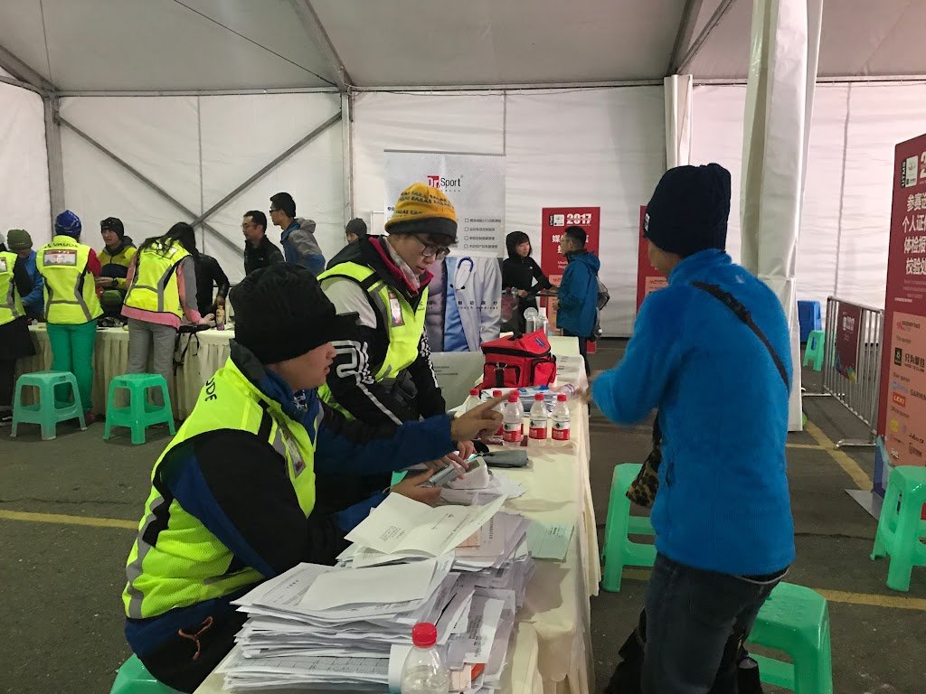
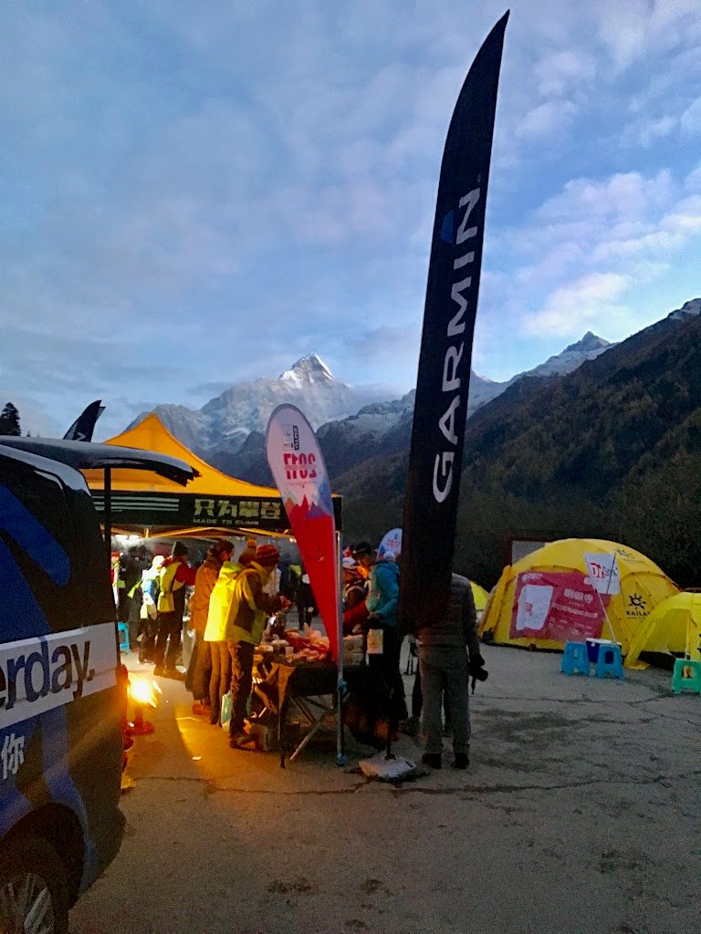
After lunch, we headed to the race site, which was only a 10-minute walk from the hotel, to exchange our number cards. Although we brought the required equipment that we had been told in advance, the directions seemed to be different, and many members of the team were told no. The order of registration was also different. The Japanese team was confused for a while because the information on the order of registration was also different. The correct order was
(1) Sign and submit the Participation Agreement so that your name and race number can be recognized.
(2) The participants submit the medical certificate they brought with them, and their health is checked. If necessary, a blood pressure check will be conducted.
(3) Confirmation of required personal belongings.
This time, the essentials were hat, gloves, rain top and bottom, light, cell phone and battery, long pants or tights, whistle, emergency blanket, water bottle that can handle hot water, and jacket to keep warm. Although not a must-have, the food container and folding spoon that were included in the entry prize were recommended items.
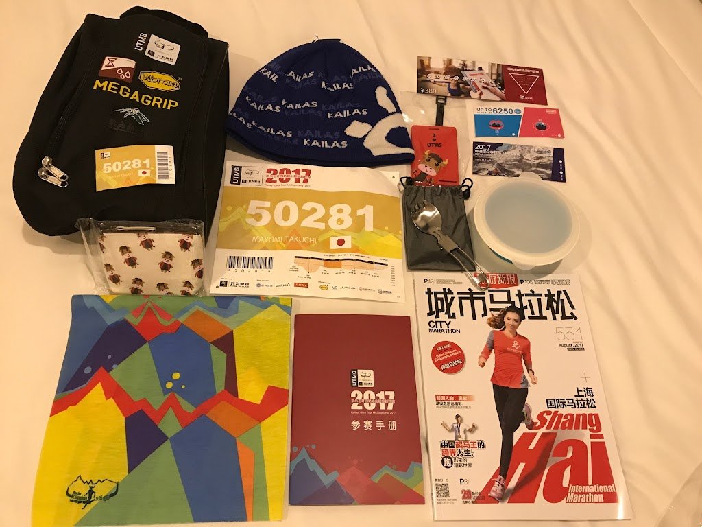
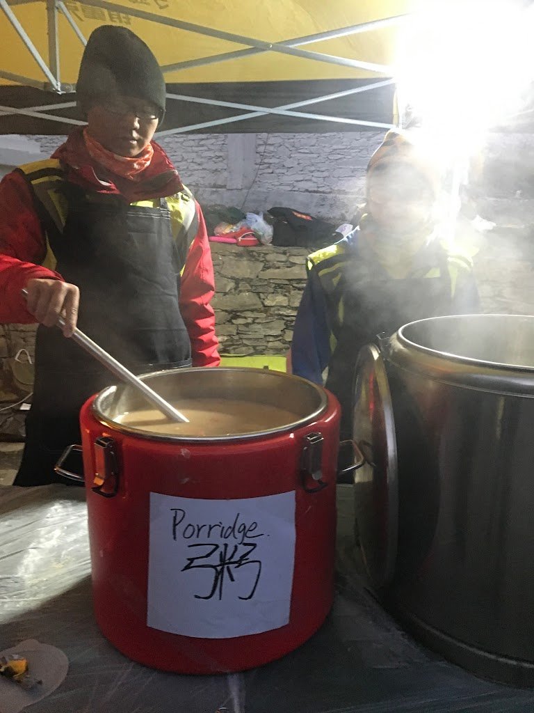
As we found out at the start of the race, the water supply was hot water only, as it was too cold and water would freeze, and food was mostly porridge, soup, and pasta. So bottles (insulated pots, heat resistant containers, etc.) and food containers are needed. There were many participation prizes, all of which I felt were substantial and ready to use.
Race day (50km)
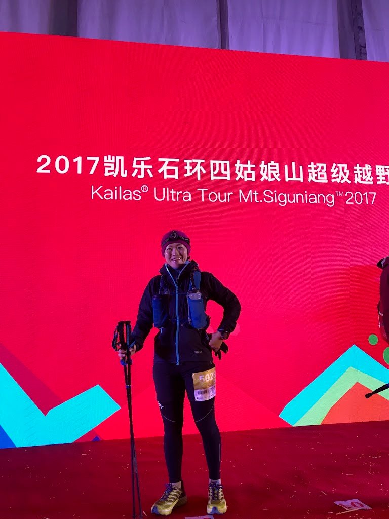
Despite the high elevation, the temperature did not drop much, about 10 degrees Celsius during the daytime, and even at 3:00 a.m., the start time of the first race, it was about minus 2 degrees Celsius, which was still considerably colder than in previous years. I thought about how to cope with the cold, but I was able to get through the race with the same equipment I use when training for trekking in low mountains in Japan in winter. The blizzard at 4000m altitude was cold, but I think the environment was more severe than the race in Nobeyama, which I recently competed in. I heard that there was snow around 4500m where other members went and the descent was scary. Depending on the course, it might have been better to have crampons.
The 50km race I participated in started at 6:00 a.m., with five checkpoints and four aid stations along the way, and the finish time was 9:00 p.m. The difference in elevation was about 1,000 meters, but the course was very steep. The elevation gain is only about 1,000 meters, but since it is hard to breathe from the start in the first place, running at a jog pace makes it hard to breathe. It is not that I cannot run, but it does not last long, and as soon as my speed slows down, the symptoms peculiar to altitude sickness (headache, nausea, dizziness, gastrointestinal problems, etc.) come on at once, so I listened to my body and just kept moving at the same pace.
Even so, I still had a hard time on the uphills, and I lost concentration and lost the course twice. There are color-coded ribbons for each category on the course, but they are sometimes obscured by strong winds or wrapped around rocks or trees, so you have to concentrate to keep looking for them or you may miss them. After the sun went down and it got dark, the reflective tape was small and difficult to see, making it even more difficult to find your way along.
I was the only Japanese in the race, but the athletes I met during the race talked to me, and it was very encouraging to be able to communicate with them in my poor English. Especially when we lost our way or when we were searching for the course at night, I felt that we were united even though we could not understand each other’s language.
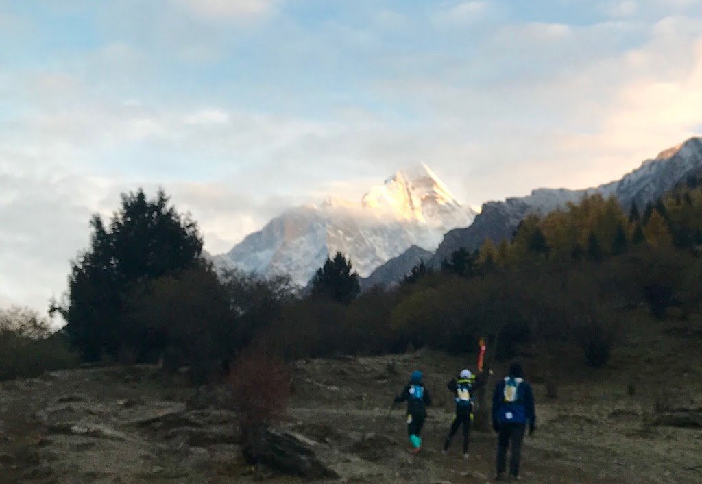
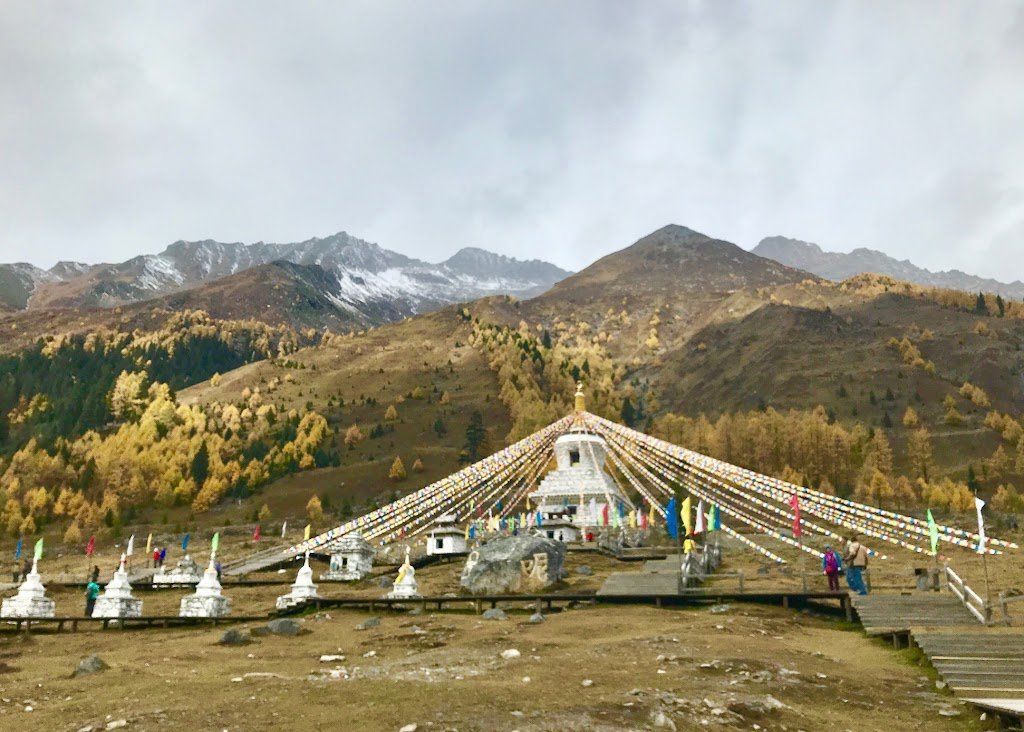
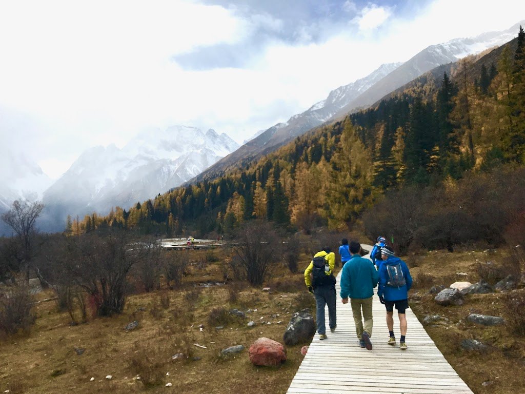
Right after the start, we climbed up the road until around 3500m elevation, and by the time we reached the first aid station, dawn broke and the mountains shining on the Morgenroth looked beautiful. From there we hit the trail and headed for the hiking trail along the river, looking up at the Four Girls Mountains in the forest where the panda was discovered. Since it was a pathway for horse trekking, we had to give way many times to the horse line and proceeded on the trail of mud, pebbles, and tree roots to avoid stepping on any lost items. Once in the park, the trail was a repetition of wooden paths and stairs, and we enjoyed the scenery at a leisurely pace, walking and stopping in line with the tourists.
The second half of the course takes you on a steep climb all the way up to 4,000 meters to the ridge line. The mountain trail encircled the town of Lilong, and we dutifully followed the endless trail while overlooking the town. The course layout differed from the information in the program, the course map distributed to us, and the actual location and distance of the aid stations, so our pacing did not go as predicted, and we were very anxious about the barrier time. The indication that there was a 3km road descent at the end after descending the mountain was also false and made us go up firmly. Also, no matter how far we went, the cheering voice kept repeating “2km to go” over and over. As a result, I ran out of savings and managed to finish 7 minutes before the final barrier.
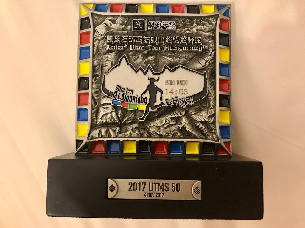
The prize for finishing the race was a long-sleeved hoodie and a trophy. The trophy was engraved with my name and finishing time. Instant hot pot was served, but I was soaked and cold from the snow, so I went straight to the hotel. The hotel was modern and clean, with heated floors and warm water in the showers. I did not expect much because it was in Tibet, but I felt it was more comfortable than when I went to Europe or the United States.
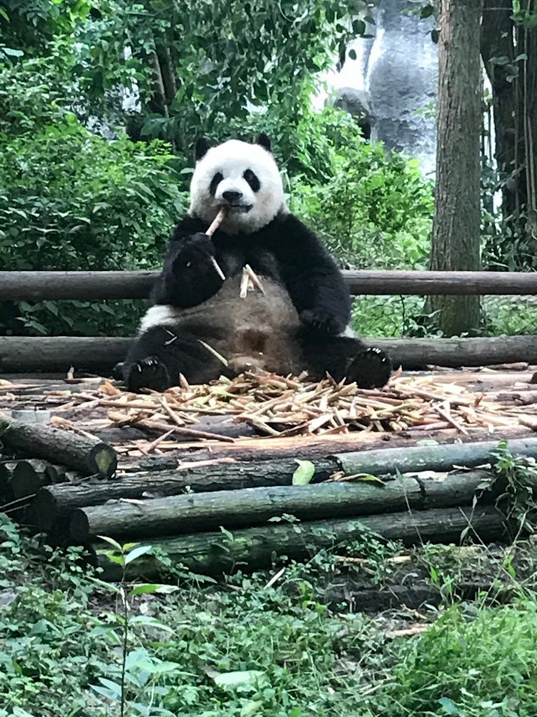
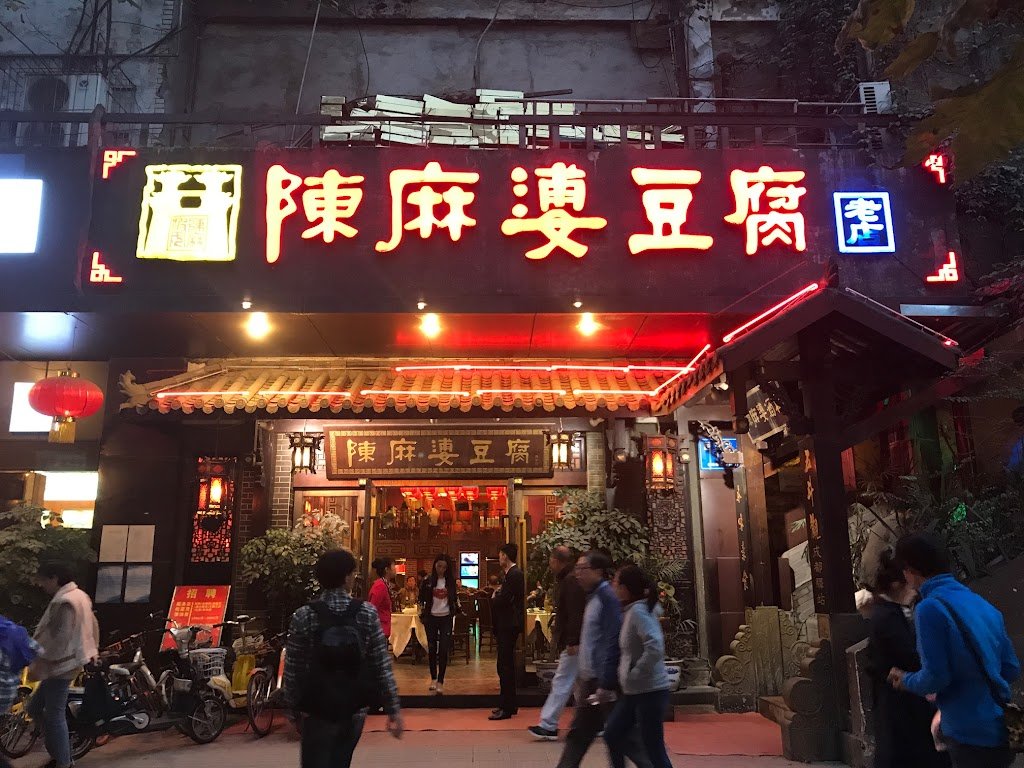
After the race, we enjoyed panda and Sichuan cuisine in Chengdu.
The day after the race, we were to return to Chengdu by shuttle bus provided by the event. We registered at the meeting time and soon after there was a roll call, but we had to stand in the cold parking lot and wait for the bus to arrive. We were told that this was the way it was for Chinese people as we spent our time as if we were being punished because of the poor arrangements, but it was very troubling. For the players who had to wait here, the knit caps they received as participation prizes were very useful. Come to think of it, it always took quite a long time to make inquiries in advance. It seems that on the continent, you need to be prepared to spend time with a big heart.
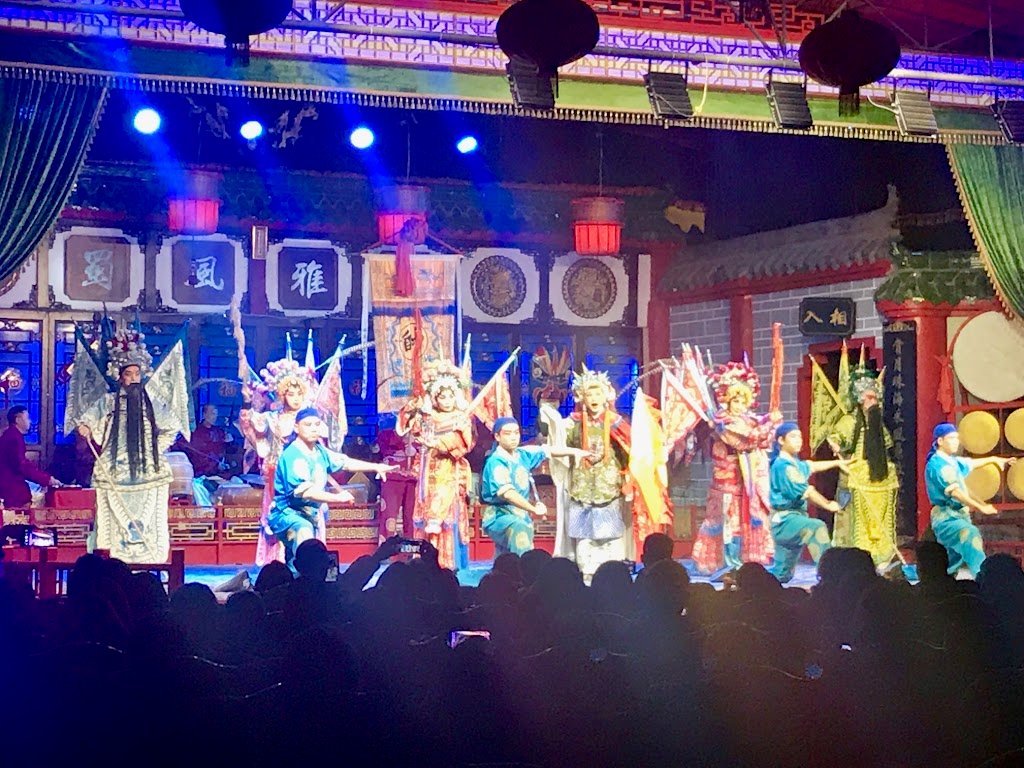
After arriving in Chengdu, we enjoyed sightseeing at the Panda Park, the Sichuan Opera, and enjoyed Sichuan cuisine represented by mapo tofu, with the added bonus of a foot massage.

I think having after-race fun is an important factor to consider when entering the country. Prices are low, so you have less spending money, and if you choose the right airline, travel expenses can be considerably reduced. While competing in a long race in Japan requires a large expense, the UTMS is a world race that you can participate in from Japan in a short and inexpensive time, and I think it is quite a fulfilling experience.
If you take the time to acclimatize to the altitude and feel as comfortable as possible, you will be able to challenge yourself in the longer distance and higher elevation categories on November 27, 2017. Training for this may be a different kind of fun than the trekking we have been doing. Needless to say now about risk management, including not being able to speak the language and even returning safely from the mountains, having physical strength and securing the route, I hope more people will be able to enjoy the wonderful course after having made such preparations as well.