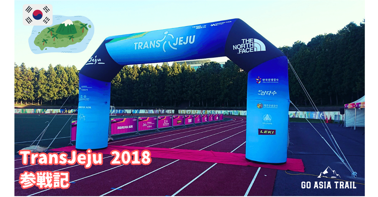
I ran TransJeju, a trail running race held in Jeju Island, South Korea last week, October 20-21, 2018. Although I DNF’d at the 73.5km mark due to a knee injury, I would like to report on what I heard from other runners.
Overview of TransJeu
TransJeju is a trail running race held on Cheju Island in South Korea. There are three distances: 111 km, 56 km, and 10 km. The race is a peak hunt for Hallasan (Mt. Halla), the highest mountain in Korea, while running on trails around Mt. The organizer is Asia Sports Connection, which is organizing TransLantau in Hong Kong.
The course looks like this: for the 111km, drop bags are available at the 73.5km marker.
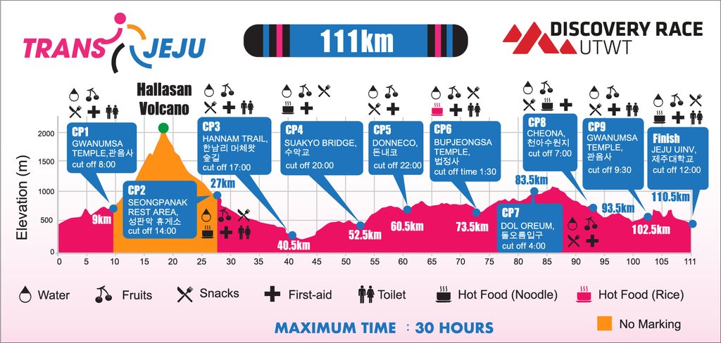
There are about 240 entries for the 111km. About 40 of them were Japanese runners.
The course has also been changed due to a change in the starting point from the 2019 event.
Access
Kansai International Airport (KIX) is convenient for access to JEJU Island.
T’way, a Korean LCC, operates daily flights from Kansai International Airport. There are also flights from Tokyo Narita Airport, but only three flights a week, and they will not be flying on Friday, October 19, 2018, the day before the race. Therefore, TransJeju runners living in the Kanto region also traveled to KIX by overnight bus or Shinkansen. KIX has strong Asian flights. It is even reported that the number of passengers using KIX has exceeded that of Narita.
It takes about 30 minutes by cab from the airport to the start point and race registration area at the Ara Campus of the University of Cheju.
Starting from the 2019 race, the starting point has been changed from the campus of the University of JEJU to the Jeju World Cup Stadium in the southern part of JEJU Island.
On the day of the race, a shuttle bus will be available from 5:00 a.m. near the Jeju Hawaii Hotel, the official hotel, to take you to the start point.
The Race
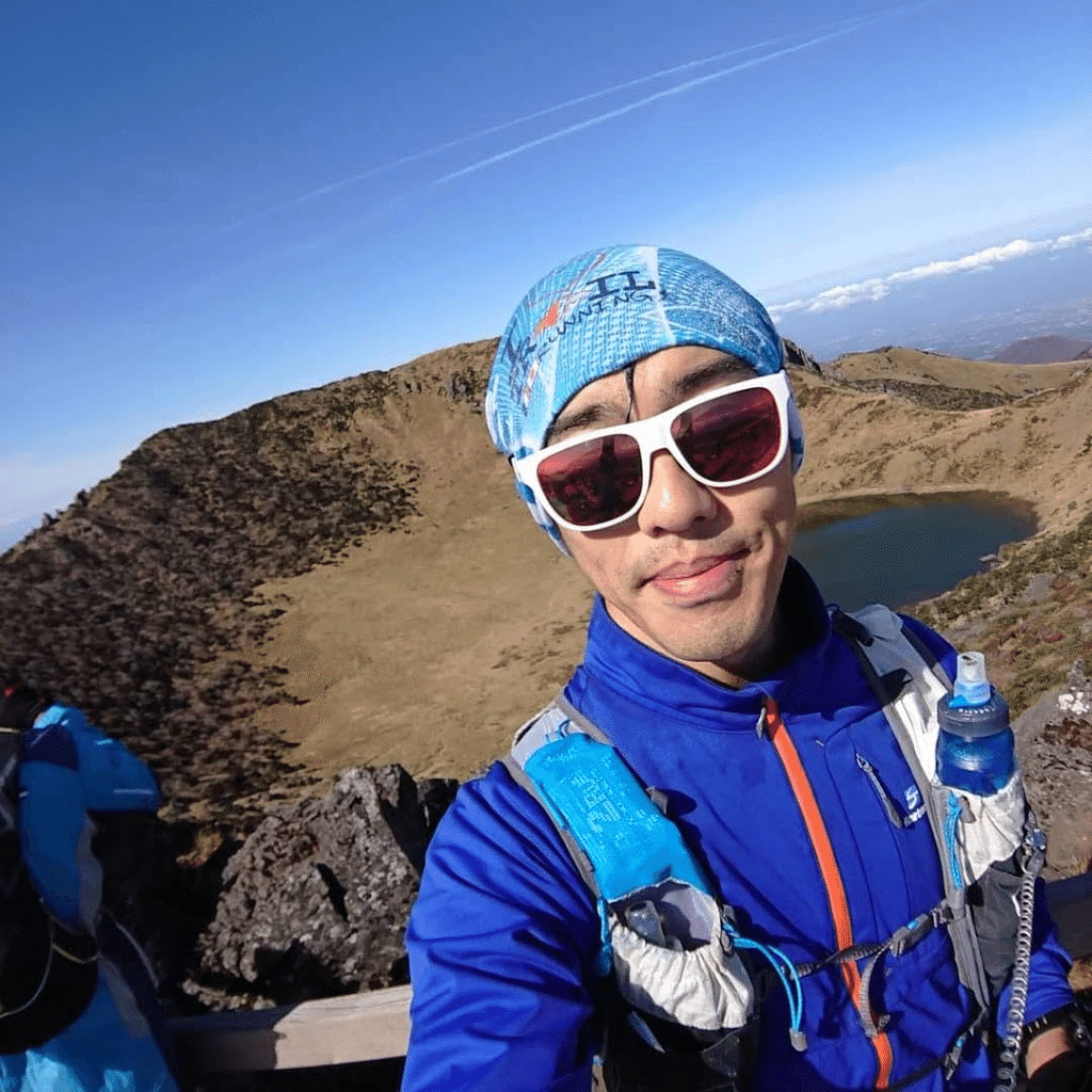
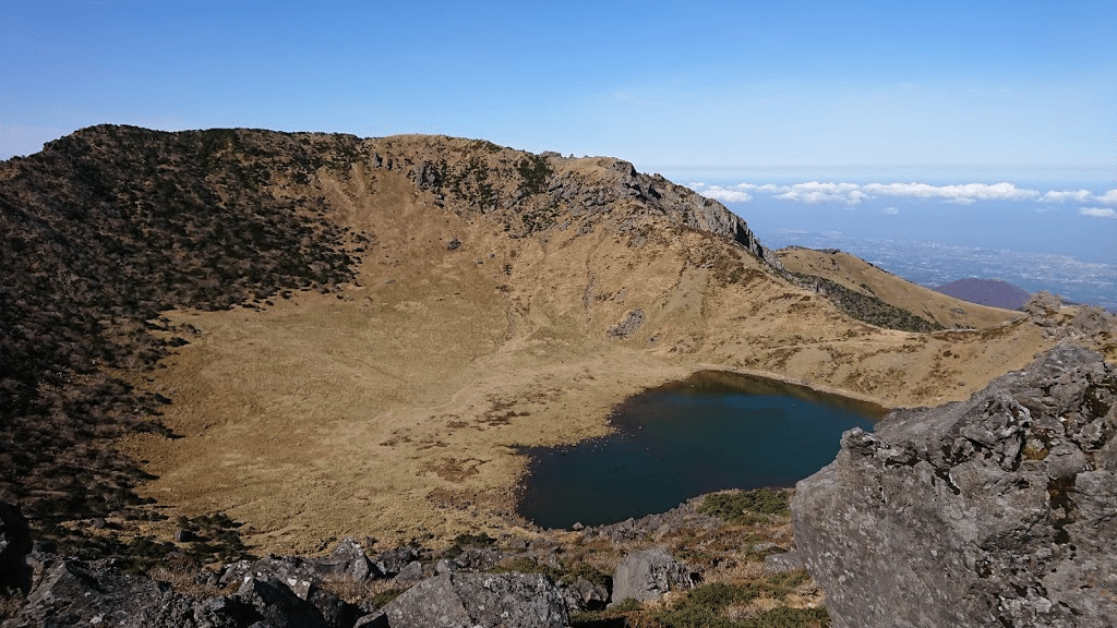
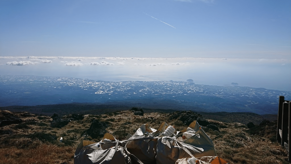
The view from Mt. Halla is spectacular!
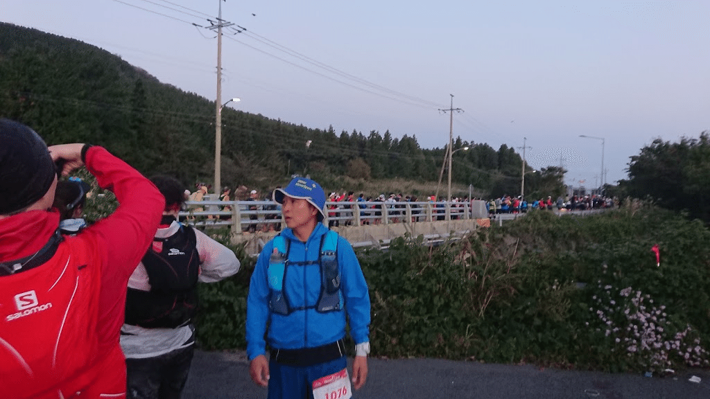
The race starts at 6:00 am at the campus of JEJU University. From there, the race climbs up to Mt. Hallasan is 1,950 meters above sea level, and the weather was fine from the morning, making for a pleasant morning. However, as it was late October, it was cold without a soft shell.
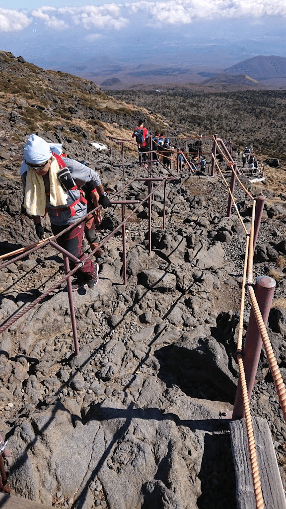
Hallasan can be climbed mostly by stairs, so it is not so hard. I think it was partly because it was the first half of the race, so we were physically fit. The views were great. Because of the clear weather, you can see the entire island of Cheju from the top of the mountain, and it is the best spot in the entire TransJeju run. However, the descent was not so easy because there were many hikers coming up the mountain, probably because it was Saturday. It’s almost like a series of stairs and gullies.
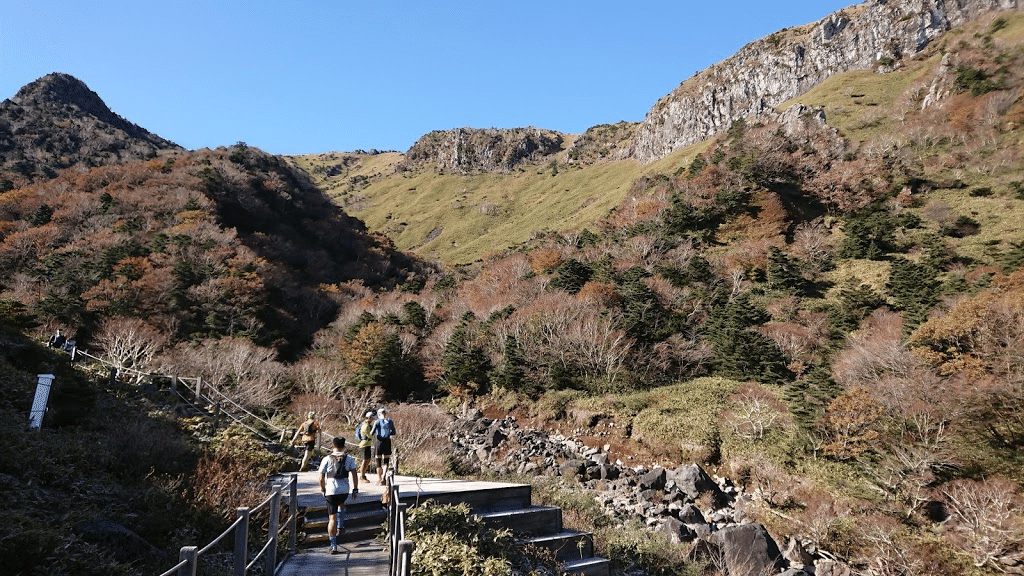
After descending Hallasan, we got a checkpoint at the 27km point and entered a forest road suitable for running. It really felt good to run here. I was so happy that I lost about 1km to 2km of the course… (lol) You can run consistently up to 52.5km. I didn’t take any pictures, but I had to crouch down to run through a drainage hole (lol).
The night trail after 52.5km is a mental exercise…lol
I was informed by one of last year’s participants that the second half of TransJeju is a “mental discipline. The course is like repeating the same part of the course all the way through, and it is mentally taxing. When I first heard this, it didn’t sound right, but when I actually ran the course, I understood what it meant.
- Dutifully walking on a gully course in a deep forest.
- No scenery. The occasional moonlight is a miracle.
- The course is so gullied that it is impossible to run.
- It takes about 17 minutes per kilometer, so if you can’t go 4 kilometers in an hour, you feel hopeless.
- The course route is difficult to follow, and to be honest, it is scary to act alone.
- It is cold. My breath turns white. It feels like you are running on a trail in the middle of winter.
- It feels as if you are lost in a maze. And the same scenery repeats itself, so I fall into a state of Polnareff.
Let me tell you what just happened! I thought I was climbing a rocky slope, but before I knew it, I was in a river with no water”… I know you don’t understand what I’m talking about, but I didn’t understand what they did to me either. I didn’t know what they did to me. I felt like I was going crazy. It wasn’t hypnosis or super-speed or any of those little tricks, I assure you. I had a glimpse of something much more terrifying.
At the 52.5 km checkpoint, I started out on my own, so I was on my own for a while. Well, to be honest, this was scary. There were not many course markings, so it was hard to find. Sometimes I even went off the route… Fortunately, I caught up with another group of runners after about 30 to 40 minutes, and I followed them for a while with a strategy of “band-aid. Then, there was a Japanese runner in that group, so I was saved. From there, I worked with that Japanese runner while talking with him until 73.5km when he DNFed. I felt it was important to be able to communicate in my native language.
To be honest, it was cold as it was late October. The wind was not so strong, so I could manage, but when it is windy, rain wear makes you cold. It was colder than STY and UTMF.
DNF and the rest of the story
I started to feel pain in my inner right knee after about 60km, and thought I should consider DNF, so I walked for a while.
I guess my knee was damaged because I repeatedly RUN & WALKed on rocky terrain…I had no problem on the flat, but it was hard, especially on the downhill. I had figured out in advance the points where I could easily DNF if something went wrong, but I figured the only thing I could do in this vicinity was the 73.5km where the drop bag was located, so I filed DNF as soon as I entered the 73.5km checkpoint. I heard from other runners that cars were not even allowed at checkpoints after this one, so now that I think about it, I commend my courage in DNFing at 73.5km (it’s overseas).
It was around 23:30 when I entered the 73.5kmt point. I arrived 2 hours before the barrier deadline. When I asked the aid staff what would happen next, I was told to “wait until the cut-off (barrier time) or the last runner arrives, unless you have an emergency,” so I waited here for almost 2 hours. 。。。。 Fortunately, I had a place to warm up and a down jacket in my drop bag, so I was not too cold. During this time, I talked to other Japanese runners and to the Chinese and Korean runners who DNFed with me in English, Katagot Chinese, and through a translation app. Translation apps are too useful. Then, as all the runners arrived around 1:15, we left the course and were transported by staff car to the starting point, the campus of Cheju University.
It was about 3:30 a.m. when we got back to our lodgings. Even at the university campus, we waited for about an hour for the shuttle bus to the official hotel to arrive, so ・・・・
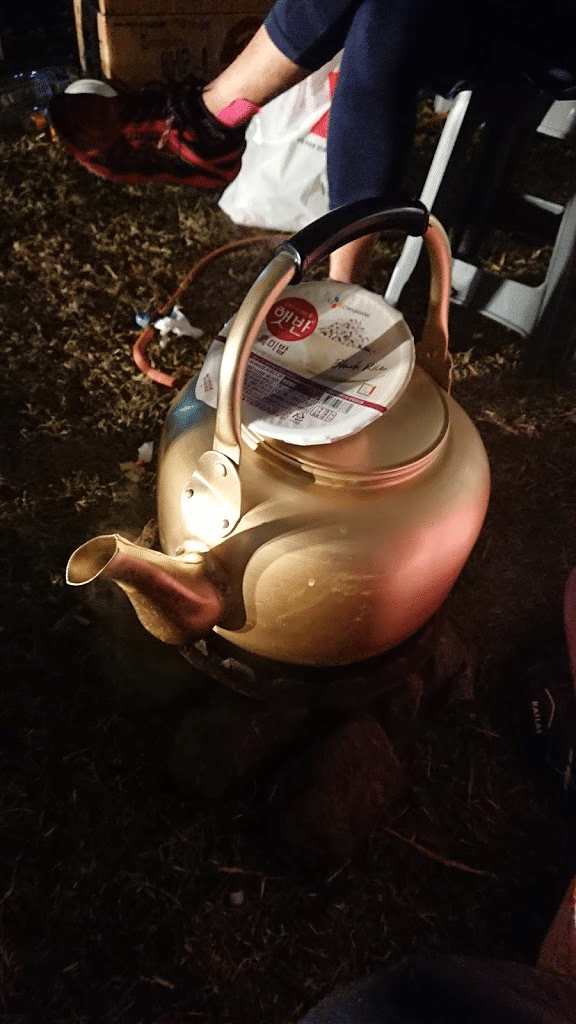
Food served at aid stations
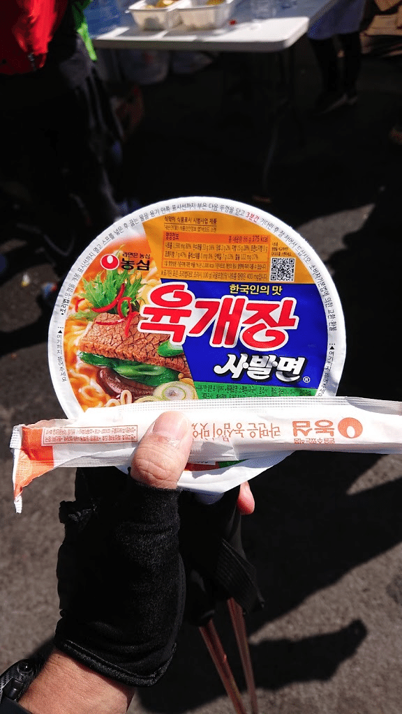
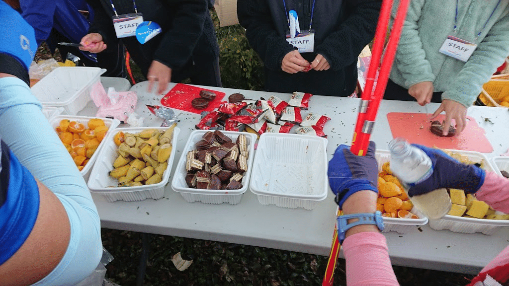
Food: Mandarin oranges, bananas, chocolate pie, spicy cup ramen (as expected in Korea), porridge
Drinks: water, Pocari Sweat, cola, apple cider, hot coffee, tea, etc.
I was informed by a person who attended last year that spicy ramen would be served as the cup noodle, but this year it was not spicy ramen, but it was hot ramen. It is risky to drink all of it, but I can manage to eat it because it tastes mellower than spicy ramen. Also, as expected in Korea, where Lotte is located, there was a chocolate pie every aide. Frankly, I get bored with the World Wide Web.
Finally…
I DNF’d after 73.5km, but here are some testimonials from Japanese runners who completed 111km. The common opinion of all of them was “I will not run 111km anymore. The right way to enjoy this race is to run 56km next year and enjoy samgyeopsal and beer at night. I agree with them; the second half of the 111km course makes me hate trail running already (lol).
The 56km is really just a delicious part of TransJeju and I FINISH it, so I really recommend it. 111km may be for those who really want to do spiritual training and enlightenment, but I don’t recommend it for everyone. I recommend you to run Shinetsu or Hacettune.
However, as the closest overseas race from Japan, I feel the potential of JEJU Island. 111km course, if the course is the same next year, I think the number of participants will decrease. The day after the race, I went to the southern part of JEJU (Seogwipo) and found a nice course in this area, so I hope they will use this area too. I personally feel that if the course is not fun to run, people will not come. I am hoping that the course will be more of a course to play around on JEJU Island!
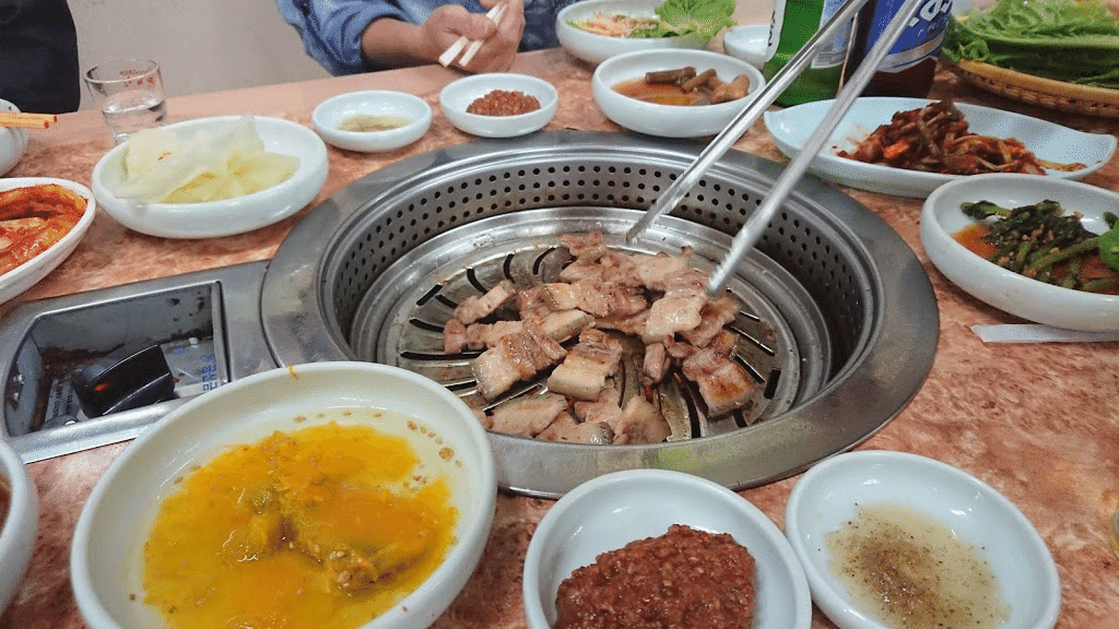
JEJU ISLAND is famous for its Kurobuta pork, and the samgyeopsal made with it is really delicious. This is my first visit to Korea, and the authentic samgyeopsal and kimchi are exceptional. The best way to enjoy it is to run the TransJeju 56km and then launch the race in the evening.
I met Mr. Shibui of Mountain Martial Arts, whom I have only met overseas for some reason, and I also made many friends with Japanese runners, so overseas races are fun.
The next race is the Formosa Trail in Taiwan in December. I hope to recover from my knee injury. Thank you for reading to the end!